Welcome to Your Review Guide of the Master Plan Draft Alternative Concepts for the Commodore Trail
This Guide is designed to provide you with shortcuts and context to some of the most important points and issues that are covered within the 537 page Master Plan Draft Alternative Concepts document. The Friends are committed to ensuring that the community can easily navigate and understand the possibilities, challenges and constraints that will have to be considered to best provide our input as part of the city’s public input, design and feedback program which will ultimately lead to a unifying design concept for the Commodore Trail Corridor. This is our moment to weigh in and influence the best solutions for our safety and our neighborhood.
Thanks for giving this material your best attention, consideration and thoughts. We encourage and welcome your questions and input and have provided links throughout these sections for you to use to share your thoughts.
Some of you might want to review the complete documents, which makes us happy! You can find them in our Reference Library below.
(click on an icon to view the section)

Informing Studies & Surveys

Master Plan Alternative Concepts

Upcoming Review Meetings & Reference Library
This Guide supplements the City of Miami’s Master Plan website found here.
Informing Studies & Surveys
Professional planners, designers, and engineers start by gathering facts and figures. We can too. In this 5 mile long project, there are a gazillion facts and figures. But we are not deterred. So let’s dive in!
The first step in the master plan process is to gather factual information and details in support of the planning and design processes, surveys and analyses were performed or gathered. These documents are available to review in our Reference Library here so that we all can better understand the possibilities, challenges and constraints that we’ll have to consider as we provide community input on these concepts.
Here are some highlights from the informing data that might interest you.
(click on an icon to view the section)

Trees & Plantings

Traffic and Accidents

Topographic & Boundary Surveys
Commodore Trail Master Plan Design Reference Library
Tree Resource Documents
Miami Canopy Collation Tree Canopy Report COMMENT
Tree Canopy Survey – Coming Soon COMMENT
Traffic & Accident Reports
Complete Traffic & Safety Memorandum COMMENT
Crash Data & Safety Review COMMENT
Topographic and Boundary Surveys
Additional Studies
Trees & Plantings
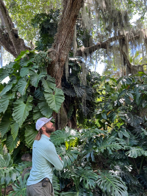
The Grove’s incredible trees have been cited by many as the Commodore Trail’s central and unique feature. Most Friends agree. The plan’s preparation included a detailed tree survey and a recommended ‘palette’ of tree species that could be added to the existing canopy.
Here’s a detailed survey of the Commodore Trial corridor’s existing tree canopy.
Proactively planting trees makes sense. This is the summary of recommended trees for the improved Commodore Trail Corridor that are thoughtfully selected for scale, resilience, and appropriateness for the existing tree palette of the Trail.
Additionally, the draft plan identifies innovative tree protection strategies and techniques that can be employed to maintain and improve the health of new and existing trees.
Independently, the Friends of the Commodore Trail co-sponsored with Dade Heritage Trust the Miami Canopy Coalition’s county-wide policy recommendations found here. The Friends plan to proactively implement these recommendations along the Trail’s corridor in a continuing program of tree stewardship.
Traffic & Accidents
Making the Trail roadways safer is priority #1 and getting a clear understanding of where and why the hazards are there is the first step in creating effective solutions. The master plan project conducted new surveys and gathered pre-existing data. These are some of the findings. Fasten your seatbelt!
During the five-years of the study timeframe (2017-2022), more than 3,000 motorized vehicle crashes occurred in the study area. Eight fatalities and 414 injury crashes were reported. Most crashes occurred at the Main Highway-Grand Avenue intersection or on South Bayshore at the intersections of 27th Ave, Darwin St, Aviation Ave, Kirk St and the entrance to Mercy Hospital.
A map identifies the locations of reported pedestrian and bicycle accidents. Professional observers have stated that many more unreported accidents occur than are reported.
Analysis of a sample of runners and cyclists that track their exercise data identified areas of high use by those groups.

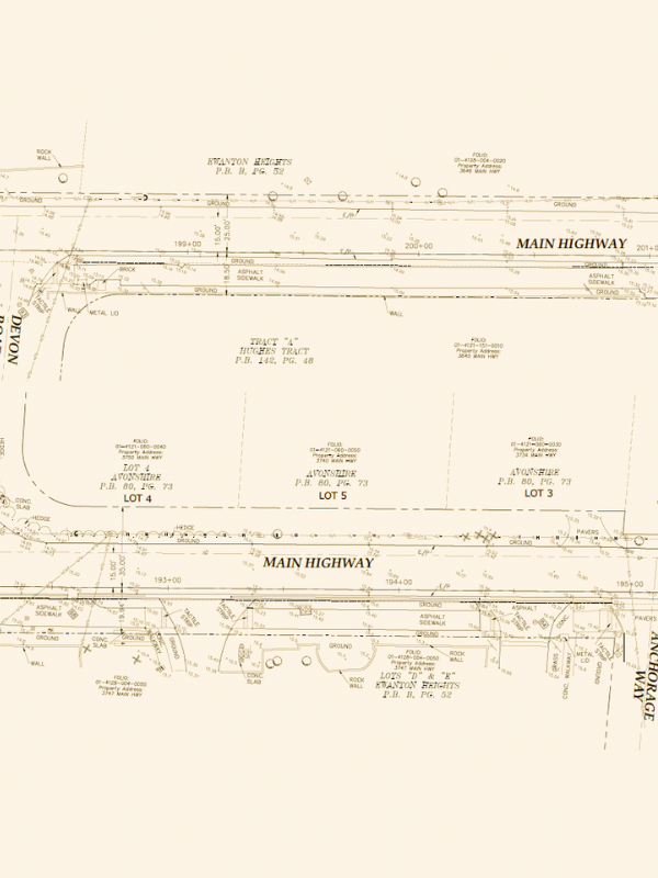
Topographic & Boundary Surveys
The devil is always in the details, so that might be a good place to start. Here’s a link to the baseline survey of the Corridor’s current property lines, roads, elevations, rocks and trees. It’s not absolutely everything, but it is the starting point for the engineers’ and designers’ later work. Maybe yours too…
The portion of the roadway from Monty’s to Mercy Hospital (aka “Segment three”) already has a design proposed by the County’s Department of Transportation and Public Works (DTPW). An extract of that plan’s draft drawings can be found here